We were up early this morning and in road construction mode. The dips in the road were filled in with rocks and we should be able to sail down this little hill without the hitch causing any trouble. Now if the transmission cooperates that too would be a bonus. Hopefully we will get back to the staging area and if necessary, call a tow truck.
 |
| Nicely laid stonework!! |
 |
| John under the truck "checking shit out" |
 |
| The infamous "hill" |
 |
| The trail was well marked!! |
We decided that today was the day we would be trying to find the infamous 1946 plane crash site. On January 19, 1946, a Royal Canadian Air Force DC3 aircraft went missing on a flight from Comox, B.C. to Nova Scotia. The aircraft was missing for 5 days before it was found at the bottom of Mt Ptolemy where it had slammed into the mountain, breaking apart and killing all seven members of the crew. It took rangers another 5 days to walk to the crash site with snowshoes on to recover the bodies. They were guided to the site by the still smoldering plane. The bodies of the seven crew members were brought back to town with the use of toboggans.
Today, the site stands as a memorial to the seven men who lost their lives on that fateful day. Mt. Ptolemy is the highest mountain in this area and stands at 9000 feet. It is believed that poor weather conditions contributed to the demise of the plane and its crew.
 |
| #46 - The Trailhead to the crash |
The trail to the crash site was awesome. There was such a wide variety of terrain but it was a very well traveled trail. On the Internet it stated that the last 300 meters of the trail was steep and many choose to simply walk the last part of the trail to the actual crash site. Neither John nor I found this trail steep and the machines handled the trail well.
 |
| York Creek |
The trail traveled along side York Creek for much of the way and there were lots of perfect spots to take pictures.
 |
| More Signage |
 |
| Well constructed ATV bridges |
 |
| The Memorial Plaque |
 |
| A list of the crew members who perished at the site |
 |
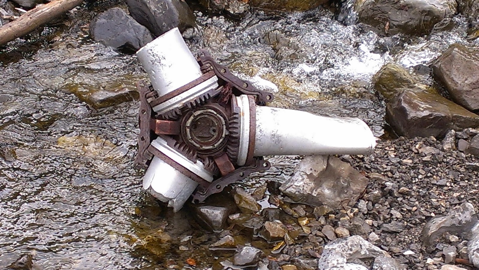
| Parts of the plane are strewn all through this area |
 |
| Large chunk of Tail Section |
 |
| Parts and pieces are everywhere |
 |
| The foliage is growing in and amongst what remains of the metal |
 |
| Along the North York Creek bed |
 |
| After 68 years, the parts are rusted but remain at the site |
 |
The waterfall that cascades down the face of the mountain
at the crash site and is the start of North York Creek |
 |
| Looks like where the RCAF emblem may have been on this piece of wing section |
 |
| And that is snow, still remaining from the previous winter |
 |
| Eventually, the foliage will claim what remains |
 |
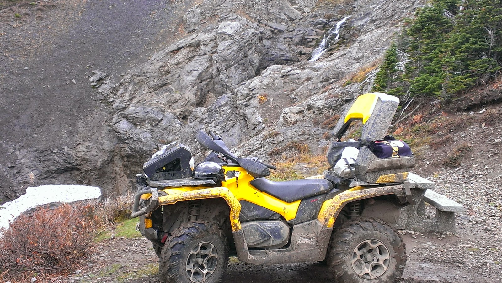
| The quads at the commemorative plaque |
 |
| Remaining snow shelf |
 |
Seven black crosses surround the largest pice of the fallen plane
(the tail section) |
 |
| Four crosses on one side and three on the other side of the tail section |
 |
One cross for each member of the crew who lost their lives in
this fatal crash |
 |
Off the mountain and into the valley of
North York Creek |
 |
| Another sweet bridge |
 |
John climbing an ugly rutted off camber
section of today's trail |
Once we had finished at the crash site we accessed another trail in this area. The map actually was helpful today. The signage on this side of the highway seems much better than what we experienced earlier in the week at McGillivary Staging Area.
 |
| Through the "Burn" |
We traveled through a huge "burn" and when I got home I "googled" it. In August 2003, The Lost Creek fire ravaged 20.000 hectares of forest. It became the largest fire in this area since 1930. Because of the high winds and extreme rugged terrain, the erratic gusting winds fueled the flames from all directions and burned for a month forcing the evacuation of two towns and having the other neighbouring towns in a one hour evacuation notice. The stark reminders of this blaze stood sentinel as we traversed this area. There was a lot of new growth coming along but I am afraid it will be several more years before this area has tall evergreens.
 |
| Mt Ptolemy through the burnt remains of trees |
 |
Out of the rocks at the base of the mountain and into
a more forest setting |
We continued on our way and traveled through a wide variety of terrain. The weather was not all that great as a fine mist accompanied us for most of the day. At one point while we were in the higher elevations, we actually had to put our rain gear on as it really came down on us. It was at this point that one of the many burnt trees had fallen across the trail and we had to get the axe out and chop it out of our way. There was no going around it as we were on a bit of a shelf trail with the bank on one side and a long steep edge on the other!! Nothing like having to chop our way off the mountain!!
Down in the lower elevations, the rain had stopped and we got out of the rain gear and carried on down the trail towards home.
 |
| Another awesome little creek making its was through the burn |
We eventually found good old #41 sign and made the final turn to take us back to the road and the camper. Once we accessed the road, it was a quick trip home and we arrived safe and sound. It was an awesome day on the trail today and I think this trail has been my favourite so far.
Jace told us to keep an eye out for a camping spot for them by a creek and we actually found them an awesome spot. We would have actually stayed there but I don't think we would of had satellite reception because of all the trees but the site itself was awesome!!
 |
| #41 - this will lead us back to the truck |


No comments:
Post a Comment